BUILT FOR THE EXAMINER · Part 2 of 3
Subtitle: A valuation is a sequence of decisions. Nine decided cases show which one fails, and what it costs.
Part 1 took up casualty losses. Part 3 takes up the enforcement architecture being rebuilt around conservation easements. This edition sits between them, and it is about method: the order in which a valuation gets built, and the specific step at which the reported cases stop reading.
Across 377.74 acres in Madison County, Alabama, the conclusion that the ground held commercially viable limestone rested on two core holes.
The partnership's own expert testimony put the appropriate spacing at one hole every fifteen acres. Before the material was crushed and tested, shale lenses were extracted from it, and no record was kept of what came out — which made it impossible for anyone to check the aggregate against the Alabama transportation department's 2% ceiling on shale composition. The absorption forecast assumed the operation would take 15% of the market within ten years, a figure adopted without reference to the 5.1 million short tons already being produced by competitors.
The charitable contribution deduction claimed on that record was $41,635,000. In Piton Holdings, LLC v. Commissioner, 167 T.C. No. 4 (July 15, 2026), the Tax Court valued the easement at $800,000 and imposed the 40% gross valuation misstatement penalty.
Every one of those facts was in the file from the beginning. None of them required an appraiser, an attorney, or an accountant to become a geologist. They required somebody to ask how many holes were drilled, where, and what was done to the samples before anyone looked at them.
The pattern is not about geology
It would be convenient to file Piton under mining and move on. The reported cases do not permit that. Over the past three years the Tax Court and the Eleventh Circuit have produced a run of valuation opinions detailed enough to function as a manual, across quarries, lakefront acreage, suburban development parcels and coastal ranchland — and the failures land in the same places every time.
They also land in a discoverable order. A valuation is not assembled all at once; it is a sequence of decisions, each one resting on the last. When the third decision is wrong, everything downstream of it is wrong too, however carefully the arithmetic is done. What follows is that sequence, and what the courts have said at each step.
First: what is this property for?

Every valuation begins with an answer to that question, and highest and best use is the name for the answer. The Tax Court restated the test this month in Malibu Valley Land: "A property's highest and best use is the most profitable use that is legally permissible, physically possible, financially feasible, and maximally productive."
Four conditions, and the first one is not a market question at all. It is a legal one, and it is where the largest disallowance in this line of cases was decided.
North Donald LA Property, LLC v. Commissioner, T.C. Memo. 2026-19 (February 19, 2026), concerned 260.48 acres in Jefferson Davis Parish, Louisiana, carved out of a larger farm and appraised as a commercial clay mine. The land was zoned A-1 Agricultural. Mining would have required rezoning to industrial, and the court found no reasonable probability that rezoning would be granted. The holding runs to a single sentence: "Because mining was not a legally permissible use, it was not the property's HBU." The claimed deduction of $115,391,000 produced $175,824.
A second holding in that case is worth pausing on, because it cuts against the intuition most advisors bring to these files. The court rejected the Commissioner's 75% civil fraud penalty under §6663(a), finding that the return's disclosures defeated any inference of concealment. The taxpayer was transparent and still lost the valuation by three orders of magnitude. Disclosing a position is not the same as supporting it.
Second: if the use requires a change, how likely is the change?
Very little resource or development land is already entitled for what an appraiser thinks it is worth. So the second decision is a probability judgment, and it is the one most often skipped.
Rising Rock Partners, LLC v. Commissioner, T.C. Memo. 2026-45 (June 2, 2026), involved roughly 226 acres of Meriwether County, Georgia granite. Claimed $12,765,000; allowed $649,955; 40% under §6662(h). The court set out the governing presumption plainly — "[a] property's current use is presumed to be its highest and best use absent evidence to the contrary" — and the exclusion that follows from it: "[w]e exclude from consideration uses dependent upon uncertain future events or contingencies that are only theoretically possible."
On the entitlement record, the court found that although the property was held for more than a year, "neither party made any effort to obtain a text amendment, rezoning, or a special use permit. No applications were filed, no preliminary discussions with county officials were initiated, and no community outreach was attempted."
In Ranch Springs, Rising Rock and North Donald alike, the land was zoned agricultural, mining was not a permitted use, and no reasonable probability of rezoning was established — in the first two, because nobody ever asked. Not a denied application. Not a pending one. None.
There is a correct way to handle a property genuinely in transition, and it is worth stating because well-intentioned work goes wrong here. Agricultural land in the path of development is not worth what it will be worth once approvals issue. Nor is it worth only what its present use supports. It sits between those two figures, and finding where in that range requires market evidence: what buyers have actually paid for comparable properties carrying comparable entitlement risk, how long approvals take in that jurisdiction, and how often they are granted. A valuation that skips the range and reports the post-approval number has substituted a hope for an analysis.
Third: what is the property worth in that use?
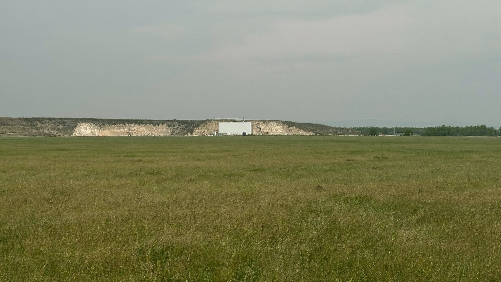
This is where the mineral cases produce their most quotable law, and the error is structural rather than arithmetic.
An appraiser concludes the highest and best use is a quarry. A discounted cash flow model is then built for the hypothetical operation — tonnage, price, margin, discounted to present value — and the resulting figure is reported as the value of the land.
It is not. It is the value of a business that does not exist, and even if it existed the land would be one input among many. Plant, permits, equipment, working capital, management and customer relationships are the others, and each of them would take a share of that cash flow.
Ranch Springs, LLC v. Commissioner, 164 T.C. No. 6 (March 31, 2025) — 110 acres in Shelby County, Alabama, zoned A-1. Claimed $25,814,000; allowed $335,500; 40% penalty. The court held the method "erroneous as a matter of law because it equates the value of raw land with the net present value of a hypothetical limestone business conducted on the land," and that "no rational buyer with knowledge of all relevant facts would pay, for one asset needed to operate a business, the entire future value of the business." That decision is on appeal to the Eleventh Circuit, No. 25-12753, argued August 13, 2026; no decision has issued.
Piton put it almost identically sixteen months later: "A knowledgeable buyer would simply not pay the entire projected value of a business for one of the assets needed to conduct the business."
The Eleventh Circuit reached the same place from the demand side in Savannah Shoals, LLC v. Commissioner, No. 24-12661 (July 16, 2026), affirming the Tax Court. The subject was 103 acres in Hart County, Georgia, appraised on a granite-quarry premise the courts rejected in favor of low-density residential and recreational use. The deduction claimed was $23 million; the easement was valued at $480,000 — a $580,000 before value against a $100,000 after value — with the 40% penalty affirmed. The model applied statewide aggregate demand to a rural submarket, disregarded at least seven competing quarries closer to the relevant markets, and projected a 67% operating margin against a 24% industry average. The court found the taxpayer's experts "overestimated annual sales of aggregate from the proposed quarry and overstated its potential profitability."
The most useful line in that record came from the Commissioner's appraiser, and the courts credited it: "land areas associated with known deposits of granite do not enjoy a price premium above non-granite area properties in Hart County." A valuable substance in the ground is not, by itself, evidence that the market pays more for the ground above it.
Fourth: what does the market actually say?
Having concluded a use and a value, the appraiser has to test both against sales. This is the step where the work is most often done in one direction.
In Kimberly Road Fulton 25, LLC v. Commissioner and South Fulton Parkway 58, LLC v. Commissioner, Docket Nos. 17852-21 and 23934-21, consolidated, T.C. Memo. 2026-36 (May 4, 2026) (Holmes, J.), two vacant Fulton County, Georgia parcels were appraised for a 600-unit assisted living facility and for high-density mixed use. The assisted living premise attached to the smaller of the two — a facility the court described as "apparently built on top of a rugged, 50-foot cliff." Claimed $9,866,000 and $15,871,000; allowed $430,000 and $610,000; 40% penalties.
The court's description of the comparable selection is the cleanest in the docket: "The comparable sales that he drew were all over the metropolitan Atlanta area and were primarily sales of developed properties. We find that these constituted a different market and were thus not comparable." Its statement of the standard is the sentence to keep: "The fair-market value of a property ultimately turns on its realistic and objective potential use."
Adjustments fail the same way. In Evans v. Commissioner and Carter v. Commissioner, Nos. 24-11882 and 24-11884 (11th Cir. August 13, 2026), the easement covered 500 acres within a 5,145-acre Glynn County, Georgia tract. Claimed $14,175,000; the taxpayers defended $10.3 million at trial; the Tax Court valued the easement at $1,000,000 and imposed the 40% gross valuation misstatement penalty; the Eleventh Circuit affirmed. What sank the report had nothing to do with its conclusion: the appraisers' "inability to explain their determination that the easement reduced by 30% the value of the Dover Hall property renders their report unreliable."
A flat percentage applied to a before value is not an adjustment. It is a conclusion wearing an adjustment's clothing, and Publication 5464, the IRS's conservation easement audit technique guide, gives the point its own section heading: "Use of Flat Percentage Cannot Be Applied to Before Value."
Two cautions on Evans, because they affect how much weight it will carry. The decision is unpublished and therefore not binding precedent in the Eleventh Circuit, and the panel was divided — Judge Branch dissented on the ground that the Tax Court should have made an express highest-and-best-use determination rather than adopting the Commissioner's expert's analysis by implication. The silviculture-and-recreation characterization of the property comes from that expert and was adopted below; the appellate majority declined to make a finding of its own.
Fifth: what does this property's own history say?

Comparable sales are second-best evidence. The best evidence is what somebody actually paid for the subject.
Lake Jordan Holdings, LLC v. Commissioner, T.C. Memo. 2025-123 (November 25, 2025), concerned a 165-acre tract in Elmore County, Alabama on Lake Jordan, with the easement encumbering 157 acres. It was appraised on the premise of a lakeside residential subdivision. Claimed $12,740,000; allowed $1,091,760; 40% penalty.
The number that decides the file is $583,000. In December 2017, investors bought a 96% interest in the limited liability company that held the land for that sum. The seller — a sophisticated local investor — put the property's absolute maximum value at $700,000, building his own figure from a per-acre rate plus an allowance for eleven lakefront lots. The deduction claimed for the same tax year was more than twenty times that.
The evidence is not always a deed. In the Dover Hall appeal, one of the errors the taxpayers pressed on the Eleventh Circuit was that the Tax Court had ignored "the actual sale price of a half-interest in the property before the donation" — the same category of proof, argued from the other side.
This is the step a non-appraiser can audit without any appraisal training, and IRS examiners are instructed to run it. The Internal Revenue Manual's real property valuation guidelines direct the analyst to document "the history of the property, including any sales within the five (5) years preceding the valuation date or any sales since the valuation date to the present," together with "the sales dates, prices, mortgage amounts, and the names of the sellers, buyers and mortgage lenders." That instruction is public. Anyone can read it and ask the same question first.
Sixth: whose work is holding this up?
Specialized property valuation is collaborative by necessity. A geologist establishes what is in the ground. An engineer establishes what can be built. A market consultant projects absorption. The appraiser integrates them, and the integration is where reports fail.
The failure is not reliance; it is reliance without interrogation — treating a consultant's conclusion as verified because the person who wrote it holds the relevant credential. The credential establishes competence in that discipline. It establishes nothing about how much material will sell, at what price, over what period, or about how many holes were drilled before anyone said what was down there.
Which returns to where this started.
What survives

A survey of nothing but wipeouts would misdescribe the law and discourage taxpayers with real positions. So consider the file that worked, which is the mirror image of Piton.
Malibu Valley Land, LLC v. Commissioner, T.C. Memo. 2026-68 (August 17, 2026), Docket No. 20442-19 (Greaves, J.), involved 297.84 acres under easement within a 316.27-acre property in the Santa Monica Mountains. The partnership claimed $32,075,000. The Commissioner disallowed the deduction outright and, in the alternative, valued the easement at $4,650,000. The court took neither figure, valuing the easement at approximately $19.7 million with the precise deduction left to a Rule 155 computation, and faulting both sides' experts — it observed of the Commissioner's that he "appeared unfamiliar with the underlying work reflected in the appendices."
What distinguished the file was a vested tentative tract map. On the northern portion, California's vesting statute locked in the development standards in effect in 1988, insulating the parcel from later local downzoning and supporting 22 lots. On the southern portion the same instrument did not help, because a vested map does not limit the application of state law. Coastal regulation adopted afterward defeated the 34 lots claimed there, and the court valued that acreage on a per-acre basis instead.
That is the whole lesson in one file. The appraisal survived because it was built on an entitlement record that existed, and it survived only to the extent that record reached. Where the paper ran out, so did the value.
No accuracy-related penalty was sustained. The court found reasonable cause and good faith under §6664(c)(1) in the partnership's reliance on a qualified appraisal.
The arithmetic of the penalty, stated precisely
That outcome is not a matter of judicial mood, and the distinction it turns on is one most commentary blurs.
For charitable contribution property, §6664(c)(3) shuts off the reasonable cause defense for both substantial and gross valuation overstatements — and then restores it, in subparagraphs (A) and (B), only for substantial ones, where the claimed value rested on a qualified appraisal and the taxpayer also made a good faith investigation of value. At the gross level, 200% or more of the correct value, there is no qualified-appraisal escape hatch at all.
The practical consequence: a valuation that lands within a defensible range of the right number keeps a defense that a valuation off by a multiple has already forfeited. The gap between a supported number and an aggressive one is not a matter of degree. It is the difference between having an argument and not having one. (Authorities predating 2010 number this provision §6664(c)(2); it was redesignated.) Appraisers carry their own exposure under §6695A.
What the appraiser concluded, and what the record supported
| Case | The premise the valuation rested on | Claimed | Allowed | Share allowed |
|---|---|---|---|---|
| North Donald | A commercial clay mine on land zoned exclusively agricultural | $115,391,000 | $175,824 | 0.2% |
| Piton Holdings | Commercial limestone across 377.74 acres, resting on two core holes | $41,635,000 | $800,000 | 1.9% |
| Ranch Springs | A limestone business, valued whole and assigned to 110 acres of A-1 land | $25,814,000 | $335,500 | 1.3% |
| Savannah Shoals | A granite quarry serving statewide aggregate demand at a 67% margin | $23 million | $480,000 | 2.1% |
| Kimberly Road / South Fulton | A 600-unit assisted living facility on the smaller parcel; high-density mixed use on the larger | $9,866,000 / $15,871,000 | $430,000 / $610,000 | 4.0% |
| Rising Rock | Granite extraction the local market would absorb | $12,765,000 | $649,955 | 5.1% |
| Evans / Carter | A 30% reduction in value nobody could explain | $14,175,000 | $1,000,000 | 7.1% |
| Lake Jordan | A lakeside subdivision, on land whose owner had just changed hands for $583,000 | $12,740,000 | $1,091,760 | 8.6% |
| Malibu Valley Land | 56 lots under a vested tentative tract map | $32,075,000 | ≈$19.7 million | ≈61% |
Ordered by what survived, not by date. Every decision but the last carried the 40% gross valuation misstatement penalty. Ranch Springs is on appeal to the Eleventh Circuit, No. 25-12753, argued August 13, 2026. Savannah Shoals is reported as a "$23 million" deduction in the opinion itself; no source states an exact figure. The Malibu Valley figure is approximate because the court left the deduction to a Rule 155 computation, and the share column is calculated, not quoted.
The last row differs from the other eight in kind, not in degree. In the first eight, an appraiser decided what a property could become and then priced that future as though it had already arrived. In the ninth, an appraiser found a document establishing what the property was already entitled to become, and priced that — and the number survived to the extent the document reached, and no further.
Six questions, in the order the decisions get made
An attorney or accountant reviewing a completed report cannot re-derive the value and should not try. The reviewable parts are narrower than that, and they track the sequence above.
One. What use does this report conclude, and is that use legally permitted today? If it is not, what does the report show about the probability of getting permission — an application, a pre-application meeting, a comparable approval in that jurisdiction, anything?
Two. If the property is in transition, where in the range between present use and approved use does the report place it, and on what market evidence?
Three. If value comes from a discounted cash flow, what does the model actually value? Ask how the return to capital, operations, equipment and management was removed before anything was assigned to land. A model that never subtracts the cost of creating the business is not a land valuation.
Four. Are the comparables in the subject's market, in comparable condition and entitlement posture — and is every material adjustment derived and explained on its own, rather than a single blended percentage doing the work?
Five. When and for how much was this property acquired — or any interest in the entity that holds it — and does the report address it? One email answers this, and it is the question the examiner is instructed to ask.
Six. Which conclusions came from other professionals, and what did the appraiser do to test them? "Relied upon" is not an answer. Ask about sample sizes and testing protocols; in Piton, the answer was two holes and it was disclosed the whole time.
Two structural points sit underneath all six. A qualified appraisal and a supported appraisal are different documents — 26 CFR §1.170A-17 governs who may sign and what the report must contain, and says nothing about whether the analysis holds; a report can satisfy every formal requirement and still produce the North Donald result. And there is no correction cycle. Examination is not a compliance audit looking for missing initials; it is a test of whether the value is right and the reasoning is credible enough to rely on. Reports are not sent back for revision. The Service accepts the value or develops its own and litigates the difference, which means every point of leverage an advisor has — scope, effective dates, documents produced, the identification of the Service as an intended user, the appraiser's obligation to support the work under examination — exists before the report is issued and not after.
The through-line

Strip out the acreage and the geology and every case above reduces to the same error: the value an owner or a promoter believes a property holds is not the price a market will pay for it, and the tax system has never measured anything but the second one.
A quarry that has not been permitted is not a quarry. A subdivision that has not been entitled is not a subdivision. A deposit in the ground is worth what buyers of ground with deposits in it have actually paid — which, in Hart County, Georgia, turned out to be no premium at all.
That is not a tax rule. It is the ordinary discipline of valuation, applied by a reader with no stake in the answer, who was not there, and who will not accept assertion in place of support. It is the same discipline that governs a marina, a processing plant, a landfill or a farm, and the same one that decides whether a lender's collateral position survives a workout — a mineral or development premium with no market evidence behind it is a value that disappears exactly when it is tested.
In a return-supporting valuation, that reader is guaranteed to exist. This series has been describing him since the first edition: the examiner who was always going to open the file.
A question for your practice: When a valuation crosses your desk, is the first thing you check the conclusion — or the zoning?
Solving complex real estate and personal property problems is the work our team does — untangling what a client actually owns across land, water, minerals, timber, equipment and the operating business, and turning that inventory into numbers counsel and advisors can defend. In every case above, that inventory was the missing document.
If a client's holdings raise these questions — resource land, a property in transition, an operating asset where the real estate and the business are entangled — that intersection is exactly where our team works. If your firm would like a private presentation on these topics, feel free to reach out. We regularly present to law firms and legal teams (including CLE-style briefings), CPA firms and societies (including CPE-style sessions), family offices, owner-users, and industry stakeholders on complex property and specialized asset issues.
Next in the series — Part 3: the new architecture of easement and donation enforcement, and where valuation pressure moves next.
Daniel Boring, CRE®, MAI, ARA, ASA | Senior Vice President – Valuation Advisory Services | Kidder Mathews
Beyond the Core Four focuses on specialized properties that fall outside the traditional industrial, retail, multifamily, and office categories. The newsletter examines how value, risk, and utility are shaped by the operational realities of assets such as quarries, marinas, agricultural facilities, processing plants, water-dependent operations, and other complex property types where the real estate is only part of the story.
Sources and further reading: Ranch Springs, LLC v. Commissioner, 164 T.C. No. 6 (2025), appeal pending, No. 25-12753 (11th Cir.); Piton Holdings, LLC v. Commissioner, 167 T.C. No. 4 (2026); Savannah Shoals, LLC v. Commissioner, No. 24-12661 (11th Cir. 2026); North Donald LA Property, LLC v. Commissioner, T.C. Memo. 2026-19; Rising Rock Partners, LLC v. Commissioner, T.C. Memo. 2026-45; Beaverdam Creek Holdings, LLC v. Commissioner, T.C. Memo. 2025-53; Lake Jordan Holdings, LLC v. Commissioner, T.C. Memo. 2025-123; Kimberly Road Fulton 25, LLC v. Commissioner and South Fulton Parkway 58, LLC v. Commissioner, T.C. Memo. 2026-36; Evans v. Commissioner, Nos. 24-11882 & 24-11884 (11th Cir. 2026) (unpublished); Carter v. Commissioner, T.C. Memo. 2023-133; Malibu Valley Land, LLC v. Commissioner, T.C. Memo. 2026-68; IRS, Internal Revenue Manual 4.48.6, Real Property Valuation Guidelines; IRS, Publication 5464, Conservation Easement Audit Technique Guide (Rev. 1-2021); 26 U.S.C. §6662, §6663, §6664, and §6695A; 26 CFR §1.170A-17.
Case details, figures, ownership information, and property identifiers have been modified or generalized to protect confidentiality. The discussion is based on real-world appraisal and advisory experience and is presented for educational purposes only. It is not intended as valuation advice, legal advice, tax advice, accounting advice, or investment advice for any specific property, transaction, or dispute.